Name of Monument:
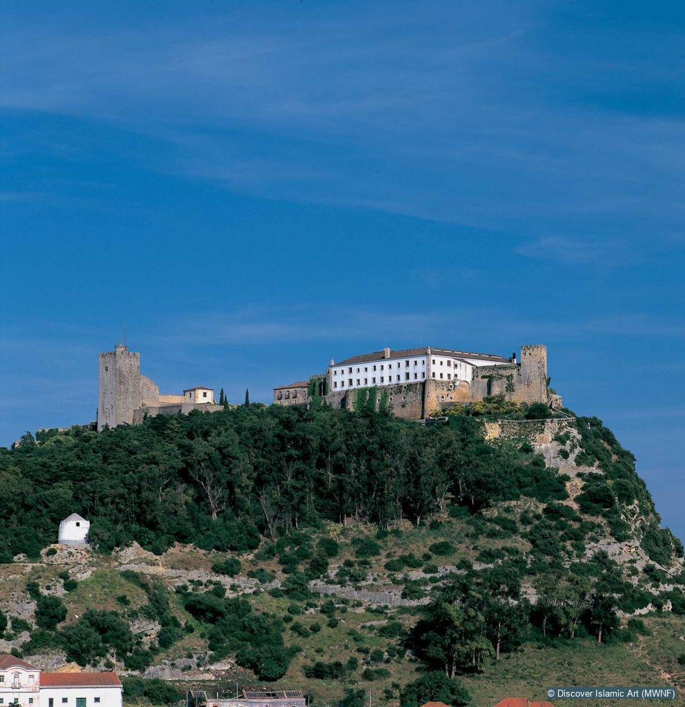
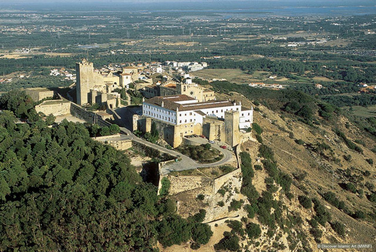
Castle of Palmela
Location:
Palmela, Setúbal, Portugal
Date of Monument:
Hegira 2nd/3rd–7th / AD 8th/9th–13th centuries
Period / Dynasty:
Umayyad, early Taifa, Almoravid
Description:
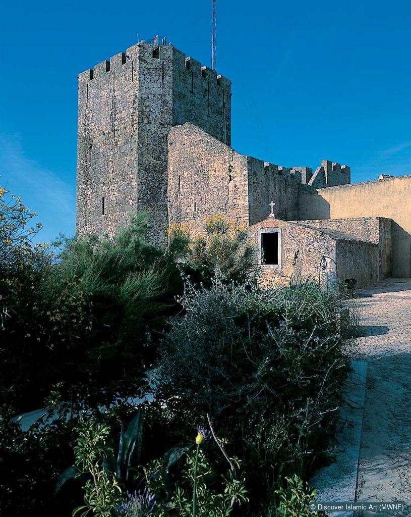
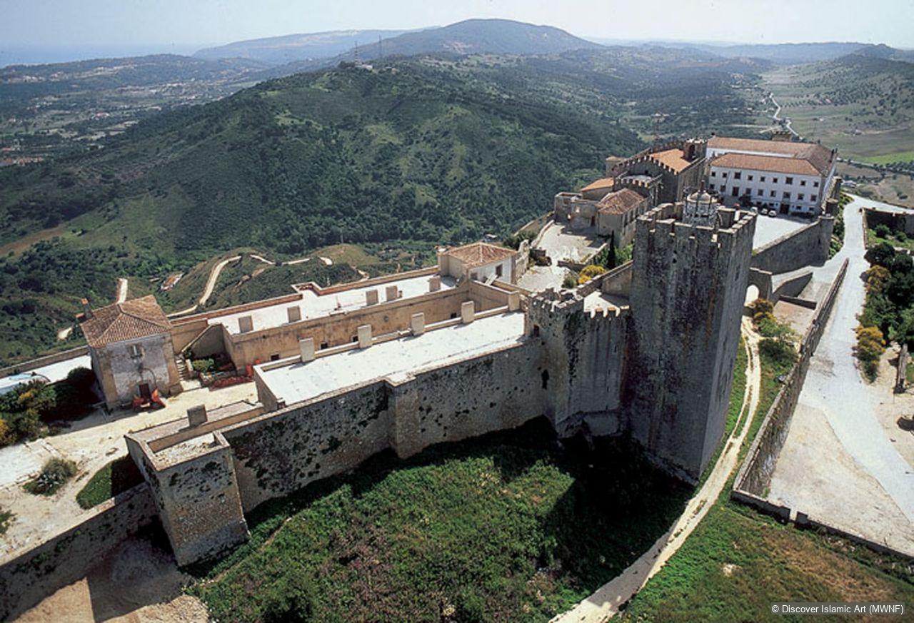
The original plan of the castle was rectangular, had five or six towers and occupied the highest level of the hill. It is thought that the definition of this perimeter, corresponding to the citadel, was made during the AH 4th / AD 10th century, when the Berber family Banu Danis settled in Alcácer and governed the Arrábida region. However, there is material evidence of the occupation of this area dating back to the end of the AH 2nd / AD 8th century, associated with earlier habitations and defensive structures whose vestiges are still not very certain. This is the case with the corner tower in the northeast, a bastion to protect the most vulnerable side, the base of which is formed by large blocks of stone built onto the rock, forming a stepped footing. It is built according to the 'header and stretcher' bonding technique, and various phases of reconstruction can be distinguished. The towers of the north wall, spaced apart regularly and projecting only slightly from the wall, show similar stone bonds, with more than one phase of construction. Two of them spring, like the corner tower, from a modest stepping arrangement consisting of two levels, using the same building technique but sometimes with the spaces of the joints filled in with small stones.
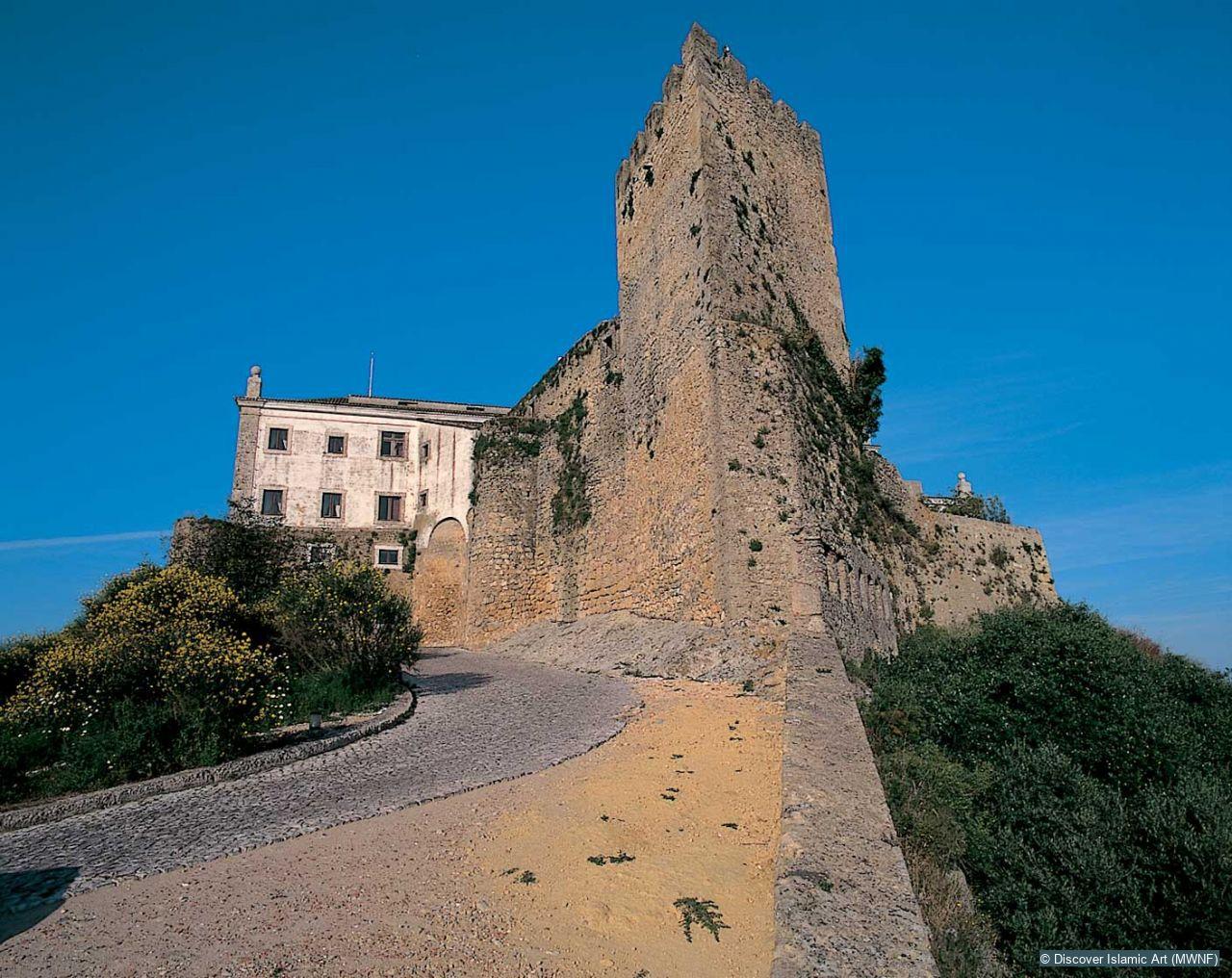
The reconstructions carried out after the AH 4th / AD 10th century use bonds of medium-sized irregular stones, laid in courses, joined by mortar and consolidated at the joints by small stones and fragments of brick. The extension of the walled enclosure to the west must have been made during the AH 4th / AD 10th century, to give this area the function of a gate to the fortress. It is possible, although this is not verified archaeologically, that a small medina (town) was located here. The major work at the northwest end of the citadel, for the construction of the keep and related buildings, concealed the system of access to the castle during the Islamic period. It is probable that the citadel had a gate giving direct access and that when the wall was extended another solution was sought, possibly an entrance built at an angle. The finding of large blocks of tabiyya (compressed dry mud) wall in the archaeological excavations may also be evidence of a construction of this type.
Inside the citadel several residential structures relating to the Umayyad period have been identified against the north wall, suggesting continual occupation until the AH 5th / AD 11th century. Their kitchen areas have provided abundant remains of ceramic vessels. During the AH 5th and 6th / AD 11th and 12th centuries some constructions were reused and adapted and others completely replaced. Next to the east wall some vestiges can be seen dating from the brief years of the Almohad presence at Palmela (AH 587–90 / AD 1191–4) but no changes to the military architecture are recorded from that period. The general analysis of the rectangular enclosure of the citadel allows us to define a residential area which was used by the political and military authorities, located in the north and demonstrated by the variety and quality of the household objects found there and by the careful techniques of construction and finish. Another area, in the east, was probably destined for the garrison, and in the southern half were the silos, rubbish pits and the aljibe or cistern.
Palmela Castle was originally laid out over a rectangle, and it sat on the highest plateau of the hill surrounded by five or six towers. This perimeter, which corresponds to the citadel, is thought to have been defined in the AH 4th / AD 10th century, although there are older remains, such as the tower in the northeast corner, whose footing was built using the soga e tissão technique (alternating rows of headers and stretchers). The westward extension of the wall must have been effected in the AH 4th / AD 10th century to allow this area to be used as a bailey.
How Monument was dated:
The dating of the walls and remaining built structures found on the inside of the citadel is based, apart from the analysis of the characteristics of the construction techniques, on a stratigraphic reading related to them and the ceramic objects found in these locations. Some Carbon 14 dating analyses were also carried out. The few written sources available for the region between Lisbon and Alcácer do Sal in the Islamic period contribute to the verification of certain of these hypotheses.
Selected bibliography:
Fernandes, I., “O Castelo de Palmela: Herança Islâmica e Domínio da Ordem de Santiago”, in Mil Anos de Fortificações na Península Ibérica e no Magreb (500–1500): Actas do Simpósio Internacional sobre Castelos.ed. I. Fernandes, Palmela, 2000, pp.571–8.
Fernandes, I., “A Península de Setúbal em época Islâmica”, Arqueologia Medieval, 7, 2001, pp.185–209.
Fernandes, I., O Castelo de Palmela: Do Islâmico ao Cristão, Palmela, 2004.
Fernandes, I. and Picard, C., “La Défense Côtière à l'époque Musulmane: l'Exemple de la Presqu'île de Setúbal”, Archéologie Islamique, 8, 1999, pp.67–94.
Citation of this web page:
Isabel Cristina Ferreira Fernandes "Castle of Palmela" in Discover Islamic Art, Museum With No Frontiers, 2026. 2026.
https://islamicart.museumwnf.org/database_item.php?id=monument;ISL;pt;Mon01;31;en
MWNF Working Number: PT KK
RELATED CONTENT
Islamic Dynasties / Period
See also
Virtual Visit Exhibition Trail
In the Lands of the Enchanted Moorish Maiden. Islamic Art in Portugal
Download
As PDF (including images) As Word (text only)