

 Back
Name of Monument:
Castro da Cola
Location:
Ourique, Beja, Portugal
Date of Monument:
Essentially Hegira 6th / AD 12th century and Hegira 7th / AD 13th century (and, later, 15th century)
Period / Dynasty:
Almoravid and Almohad
Description:
The site identified archaeologically as the castrum or Roman military camp of Cola was known several decades ago as Nossa Senhora da Cola – its identification as a castrum is based on scholarly conjectures which consider the site as a 'Roman Lusitanian' construction. In fact, the whole region around this site was densely occupied in pre- and proto-historic times, but archaeological activity has revealed a medieval settlement here. The archaeological work was begun by Abel Viana in 1958 and extended into the 1960s.
In the Islamic period this site was known as Marjiq, a name which continued to be used even after the Portuguese conquest. In fact, the name Marachique appears in the special charter that was granted to this locality in the AH 7th / AD 13th century; the area declined in importance in the AH 8th / AD 14th century, and the council seat was transferred to nearby Ourique.
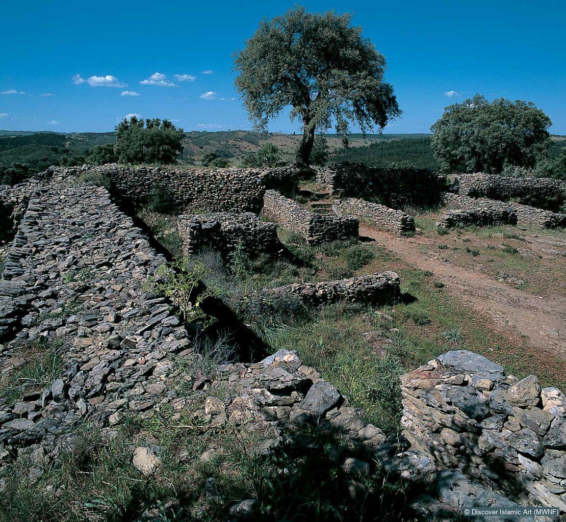
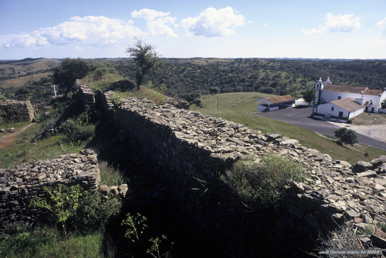
This archaeological site was excavated in the 1960s, with the aim of finding the aforementioned Roman Lusitanian occupation. However, the excavations revealed a fortified 'acropolis' which was built in the Islamic period but at a time not yet determined with certainty. This wall defines an enclosure similar to a citadel, which was occupied sporadically as a military post and underwent several adaptations, in the AH 9th / AD 15th century.
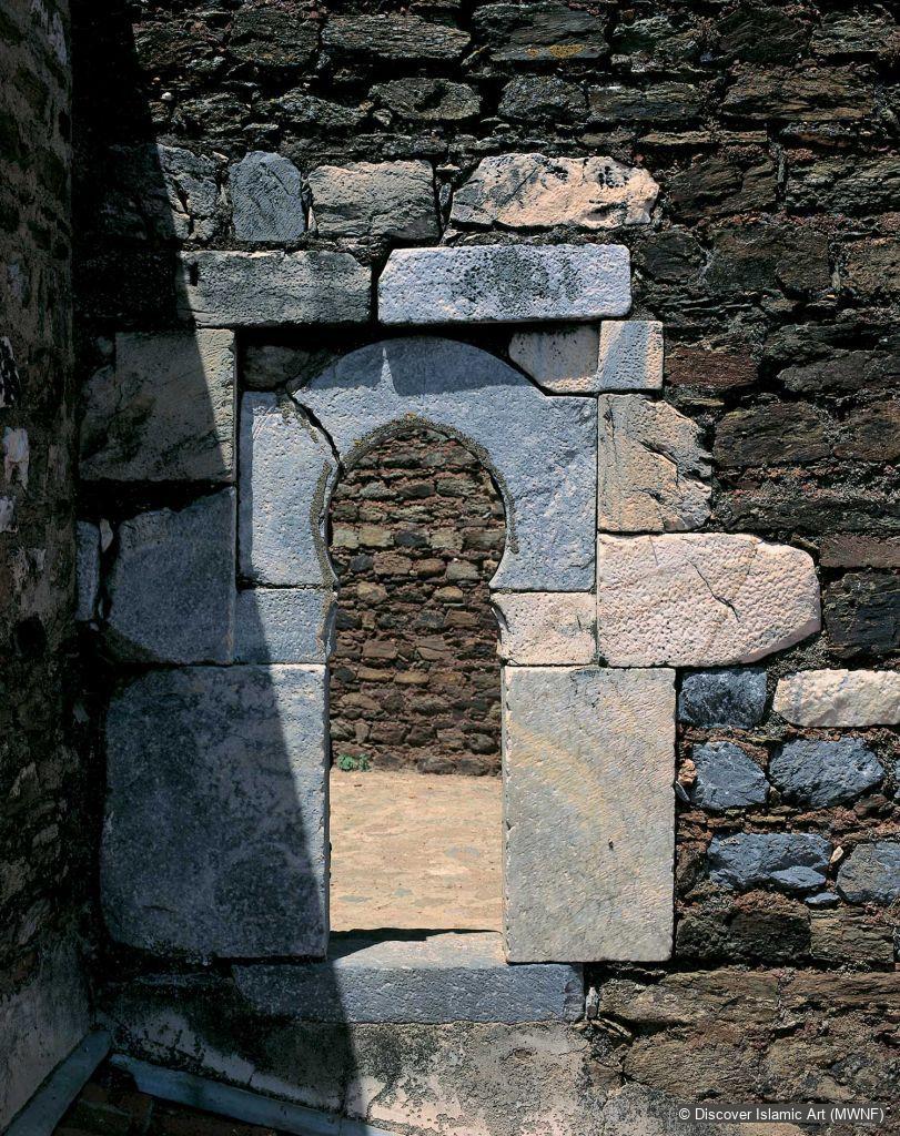
The fortification at the top, the most visible, shows an entrance which, in spite of the modifications introduced in the AH 9th / AD 15th century, is in the form of an L-shaped gateway, similar to many fortifications of al-Andalus region, especially after the AH 5th / AD 11th century.
The dominant building style is masonry made from local schist, bonded in many cases with an earth-based mortar. At certain points of the fortification walls can be seen with herringbone type stonework, i.e. a late variation of opus spicatum.
In addition to a small cistern, traces of urban dwellings are visible within these walls. From their ground plan, it is possible to determine that some of the houses were organised around a central courtyard. Tombstones with inscriptions from the Islamic period have been found in the area of the castrum. The ceramics unearthed date for the most part from the final phase of the Islamic period, but some have also been found from earlier phases.
Some constructions have been detected on the outside of the citadel, which suggests that there may have been human occupation on the slope that goes down to the Mira river and to the stream called Marchicão – a name which is reminiscent of the original name. The use of sites of this kind, offering both the advantage of natural defences and the resources provided by the combination of two water courses, has parallels in other areas of al-Andalus.
Recent sampling in various places has revealed that the walls that can be seen today, and which result from the piling up of stones extracted from the excavations, in some sections are not exactly on top of the original Islamic wall. Indeed the openings that can still be seen in the wall are also not original – they are the result of clearing the land during the excavations carried out in the 1960s.
Fortress located a short distance from the south of Ourique known in Islamic times as Marjiq, a name that survived even after the Portuguese conquest.
The wall creates an enclosure similar to a citadel that was, on occasions and with some alterations, used as a military base into the AH 9th / AD 15th century. The highest, most visible, part has a chicane entrance like many fortresses in al-Andalus, especially from the AH 5th / AD 11th century. In addition to a cistern, remains of the layout of the Islamic village can be seen within the walls.
How Monument was dated:
From textual references it is known that Marjiq/ Marachique existed during the period of Almoravid dominion. The fact that it was established as the seat of a council, in the 6th / 12th century, leads us to suppose that there was continuous occupation at least between the 6th and 8th /12th and 14th centuries. However, the possibility of a military presence already in the 5th / 11th century, in a period when this region was a frontier zone between the Taifa kingdoms of Seville and Silves, is not to be excluded.
Selected bibliography:
Correia, F. B., Intervenção Arqueológica no Castro da Cola: Relatório, Lisbon, 1997.
Lopes, D., Os árabes nas Obras de Alexandre Herculano, Separata do Boletim de Segunda Classe da Academia das Ciências de Lisboa, Vols. III and IV, Lisbon, 1911.
Mestre, J. F., Cerâmica Muçulmana do Castro de Nossa Senhora da Cola, Ourique, 1992.
Viana, A., Arquivo de Beja, Vol. XVII, parts I–IV, 1960.
Viana, A., “Diário de Escavações, Anos de 1958–1962”, manuscript, Beja: Queen Leonor Museum.
Citation of this web page:
Fernando Branco Correia "Castro da Cola" in Discover Islamic Art, Museum With No Frontiers, 2026. 2026.
https://islamicart.museumwnf.org/database_item.php?id=monuments;ISL;pt;Mon01;30;en
Prepared by: Fernando Branco CorreiaFernando Branco Correia
Fernando Branco Correia é arqueólogo e Assistente do Departamento de História da Universidade de Évora, onde lecciona as disciplinas de História e Cultura Islamo-Árabe, História de al-Andalus e Arqueologia Árabe-Islâmica, sendo ainda, nos últimos anos, responsável pelo Gabinete de Estudos Árabes (fundado por Adel Sidarus) da mesma universidade. É autor de trabalhos sobre Fortificações e História político-militar do al-Andalus, sobretudo da região entre os rios Tejo e Guadiana.
Translation by: Gilla Evans
Translation copyedited by: Monica Allen
MWNF Working Number: PT JJ
RELATED CONTENT
Islamic Dynasties / Period
See also
Virtual Visit Exhibition Trail
In the Lands of the Enchanted Moorish Maiden. Islamic Art in Portugal
Download
As PDF (including images) As Word (text only)